YEAR 9 Science
Geological history of an Australian Landform
INTRODUCTION
This guide has been created to help you with your Year 9 Science – SIS/SHE Investigation 2021. It will help you choose a landform to investigate and to locate reliable sources of information for the task.
Created by: Ms Bright | Last updated: July 24, 2021
READING LEVEL GUIDE
The following may be used as a guide to the reading level of each resource:
![]() Easier
Easier
![]() Grade level
Grade level
![]() Challenging (above grade level)
Challenging (above grade level)
KEY TERMS & CONCEPTS
- Plate tectonics
- Folding, faulting and uplift
- Volcanic activity
- Rock cycle
- Weathering, Erosion and Deposition
- Sedimentation, Compaction, Cementation
- Mass movement
- Continental drift
- Topography
See this glossary for more.
AUSTRALIA – AN ANCIENT LANDMASS
Australia is an ancient landmass and has undergone many changes over millions of years.
The tectonic forces of folding, faulting and volcanic activity have created many of Australia’s major landforms. Other forces that work on the surface of Australia, and give our landforms their present appearance, are weathering , mass movement, erosion and deposition.
(Swanson et al., 2016, p. 26)

(Coastal landforms, n.d)
Overview – General resources
PRINT – LIBRARY BOOKS
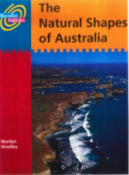
Explore high mountains, dive down to corals reefs and trek across dry mountains as you visit Australia’s landforms.
Find out how these places came to be.
Find out how these places came to be.
![]()
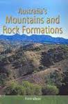
551.432 GIB
Gibson, F. (2004). Australia’s mountains and rock formations. Echidna Books.
Find out about Australia’s mountains and rock formations, how they formed, how people use and change them.
![]()
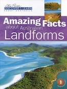
559.4 FOX
Fox, A., & Parish, S. (1997). Amazing facts about Australian landforms. Steve Parish.
Find out about a range of Australia’s different landforms.

![]()
559.4 JOH
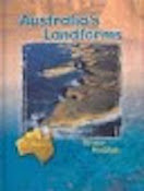
Johnson, D. (2009). The geology of Australia. Cambridge University Press.
This book provides an account of the evolution of the Australian continent over the last 4400 million years.
Note: See your Science teacher or Ms Bright for more books from the Science Department for this task.
EBOOKS
Tip: Use the keyboard shortcut Command + F to search the PDF file using your keywords.
Highly recommended. Plate movements produce mountain-building, earthquakes, volcanic activity and tsunamis, which all impact directly and often adversely on people. In this chapter you will find out about the kinds of landforms that develop from plate movements.
Highly recommended. This section of the textbook explains the processes that have shaped Australia’s landscapes and landforms.
![]()
Blewett, R. (2012). Shaping a Nation: A Geology of Australia. ANU Press.
The book explores the story of Australia’s geological evolution as seen through the lens of human impacts. Exploring the geology, resources and landscapes of Australia, the book reveals how these have helped to shape this nation’s society, environment and wealth.
Tip: Use the keyboard shortcut Command + F to search the PDF file using your keywords.
![]()
Copp, I. (2006). Geology and landforms of the Pilbara. Landscope.
The Pilbara is geologically one of the oldest regions in Australia. Most of the rocks in the Pilbara were formed between 2500 and 3600 million years ago during the Archean period, when Earth’s crust was still very young. This represents one of the world’s best preserved fragments of ancient continental crust – one of the Earth’s easliest continents.
![]()
Stretching from the ocean to the eastern hills, the Perth Region has coastal landscapes, river-valley landscapes, and forested hilly landscapes that reflect the diverse geology beneath. This field guide covers some of the classic geological localities near Perth – for instance Cape Peron has preserved evidence for sea-level changes that have featured in scientific discussions for over 50 years. The guide describes the landscape and rocks and gives explanations on how they formed. Close-up photos and diagrams help the reader recognize and interpret the localities.
![]()
The geology of Western Australia records an almost uninterrupted history of Proterozoic tectonics, including the assembly and dispersal of the Archean cratons into global-scale supercontinents, as well as worldwide glaciations or ‘snowball Earth’ events. By the end of the Proterozoic, Western Australia was starting to take on a familiar outline.
WEBSITES
![]()
Geoscience Australia. (2010). Australia Through Time Poster – Geological Time Scale. http://pid.geoscience.gov.au/dataset/ga/71079
Australia through Time charts the history of Australia from a geological perspective. Explore the evolution of life, palaeogeography, sea levels, climate change and Australia’s major mineral deposits. Download the poster from the link provided.
Geoscience Australia. (n.d.). Landforms. http://www.ga.gov.au/scientific-topics/national-location-information/landforms
General information about the variety of landforms found across Australia, from mountains to rivers to islands.
Geoscience Australia. (n.d.). Australian landforms and their history. https://www.ga.gov.au/scientific-topics/national-location-information/landforms/australian-landforms-and-their-history
Although the shape of Australia is due largely to tectonic Earth movements and long term changes in sea level, most of its topography is a result of prolonged erosion by wind and water.
Geoscience Australia. (n.d.). Significant rock features. http://www.ga.gov.au/scientific-topics/national-location-information/landforms/significant-rock-features
This website provides a brief overview for the following: Uluru, Kata Tjuta, Karlwe Karlwe, Mt Augustus, Wave Rock, Gulada, and Bald Rock.
MAGAZINE & NEWS ARTICLES
![]()
Millions of years before Aboriginal peoples roamed the land of Western Australia, earth movements buckled and faulted rocks, causing them to rise and lower, creating giant landforms. Some of our favourite natural areas such as the Stirling Range and Karijini have an incredible geological history and significance. This article also refers to Mount Augustus and the Cape Range in the Pilbara.
![]()
Fuge, L. (2021). Time travel and tipping points. Cosmos, (91), 36-47.
Example landforms
Uluru
![]()
Uluru is found in Uluru-Kata Tjuta National Park in Australia’s Red Centre. This region contains many landform features and is a place of special significance for both Aboriginal and non-Aboriginal peoples alike. Find out about the Earth movements that created these incredible landforms and the creation stories of the area’s Aboriginal traditional landowners.
Andrews, K. (2017, June 29). How did Uluru form. ABC News. https://www.abc.net.au/news/science/2017-06-27/how-did-uluru-and-kata-tjuta-form/8572068
The origins of Uluru (and Kata Tjuta) date back about 500 million years, to around the same time the Australian continent was formed.
Redden, S. (Producer). (1996). Naturally Australia: Uluru [Video]. ClickView.
This program looks at the geological history of the rock and its features. It also covers the traditional Aboriginal view of the rock’s features as explained in creation stories.
![]()
The evolution of Uluru and Kata Tjuta is explained differently by the park’s traditional owners and European scientists.
This webpage talks about the formation of Uluru and Kata Tjuta from the perspective of a geologist.
Australian Alps
Darling Scarp
More WA landforms
Annotated bibliography
 Use Citefast to generate your references in APA 7 format, then check the MLC Referencing Guide to check they appear correctly formatted.
Make sure you are able to identify the following source types to choose the correct APA 7 format:
- Book & ebook
- Magazine and newspaper article (print and online)
- Website
- Image
- Video
Annotated Bibliography
Citefast also allows you to add your annotation.
CLICK HERE for more on what an annotated bibliography is.
Curating resources
Help each other find reliable and useful resources for this task.
As you discover and locate online resources that you think are reliable and useful for your chosen landform please post the URL and note the landform it is for on this PADLET page. And below is an example of how to format your post.
Include:
- Name of the landform
- Title of the resource
- Add the URL using the paperclip/link icon to add.
- Added by [your name] (use your first and last name)
And ensure you uphold MLC’s ILT policy with your contributions.
![]()
References
Coastal landforms [Image]. (n.d.). https://fuse.education.vic.gov.au/ResourcePackage/LandingPage?objectId=184708bb-5049-43dd-9385-33d512c6a6a8
Swanson, L., Gray, N., Bowden, K., Caldis, S., Ford, N., Govers, K., Harrison, A., Newman, S., Bedson, C., Casinader, N., Chora, E., Dempster, A., Gibson, K., Head, K., Kriewaldt, J., McMeekin, T., Miles, D., Mraz, J., Westhorpe, C., & Wilson, J. (2016). Geoactive 1 NSW Australian curriculum geography stage 4 EBookPLUS and print. Jacaranda.